
Best Jeep Trails in Arizona: 7 Must-Explore Off-Road Routes
Arizona is a 4x4 paradise, loaded with breathtaking desert landscapes, rugged mountain passes, and iconic red rock terrain. Whether you’re a seasoned Jeeper or a weekend warrior, these top Jeep trails in Arizona offer some of the best off-road experiences in the Southwest. We’ve included GPS coordinates for each trailhead to help you hit the dirt faster.
CLICK IMAGES FOR GOOGLE MAPS
CLICK IMAGES FOR GOOGLE MAPS
1. Broken Arrow Trail – Sedona, AZ
Difficulty: Moderate
Length: 3.6 miles round trip
Why Go: Famous for slickrock driving, red rock formations, and epic views of the Sedona desert.
Coordinates: 34.8551° N, 111.7615° W
Broken Arrow is Sedona’s most iconic Jeep trail. Expect steep climbs, rock ledges, and stunning overlooks like Chicken Point. A short but thrilling trail packed with technical fun.

2. Backway to Crown King – Lake Pleasant to Crown King
Difficulty: Difficult
Length: ~26 miles
Why Go: This trail blends desert, creek crossings, and dense pine forest as you climb into the Bradshaw Mountains.
Coordinates: 33.9124° N, 112.2736° W
The Backway to Crown King is a rite of passage in Arizona off-roading. Make sure your rig is built for rock crawling and steep ascents. Cell service is spotty—go prepared.

3. Schnebly Hill Road – Sedona to I-17
Difficulty: Easy to Moderate
Length: 12 miles
Why Go: Scenic views, forest roads, and a great route between Sedona and Flagstaff.
Coordinates: 34.8683° N, 111.7611° W
Although parts of this trail can be rocky and rough, it’s passable for most Jeeps and offers epic photo ops of the red rock cliffs. Ideal during dry weather.
Length: 12 miles
Why Go: Scenic views, forest roads, and a great route between Sedona and Flagstaff.
Coordinates: 34.8683° N, 111.7611° W
Although parts of this trail can be rocky and rough, it’s passable for most Jeeps and offers epic photo ops of the red rock cliffs. Ideal during dry weather.

4. Apache Trail (AZ-88) – Tortilla Flat to Roosevelt Lake
Difficulty: Easy
Length: 40 miles
Why Go: Classic desert views with historical charm and cliffside driving.
Coordinates: 33.5393° N, 111.3774° W
While parts are now unpaved and rougher since storm damage, this trail is still a scenic gem. It winds through canyons, alongside lakes, and past the Superstition Mountains.
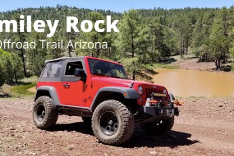
5. Smiley Rock Trail – Jerome to Prescott
Difficulty: Moderate to Difficult
Length: 22 miles
Why Go: Remote, rugged, and packed with technical obstacles, including the famous “Smiley Rock.”
Coordinates: 34.7445° N, 112.1154° W
Located in the Mingus Mountains, this trail features tight switchbacks, rocky terrain, and beautiful forested areas. High clearance and 4-low are a must.
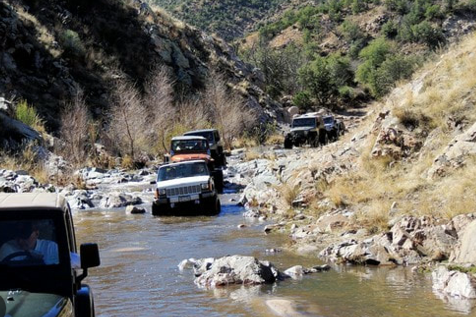
6. Charouleau Gap – North of Tucson, AZ
Difficulty: Difficult
Length: ~20 miles
Why Go: One of southern Arizona’s most challenging Jeep trails.
Coordinates: 32.4453° N, 110.7661° W
Expect steep rock climbs, water crossings, and narrow passages. This trail is not recommended for stock Jeeps. Go with recovery gear and an experienced crew.
Length: ~20 miles
Why Go: One of southern Arizona’s most challenging Jeep trails.
Coordinates: 32.4453° N, 110.7661° W
Expect steep rock climbs, water crossings, and narrow passages. This trail is not recommended for stock Jeeps. Go with recovery gear and an experienced crew.

7. Box Canyon – Florence, AZ
Difficulty: Easy to Moderate
Length: 15 miles
Why Go: Great for beginners who want a fun mix of sand, wash driving, and scenic canyon walls.
Coordinates: 33.0263° N, 111.2008° W
Box Canyon offers towering rock walls, mild challenges, and beautiful desert views. A great trail for those new to Arizona off-roading or testing out upgrades.